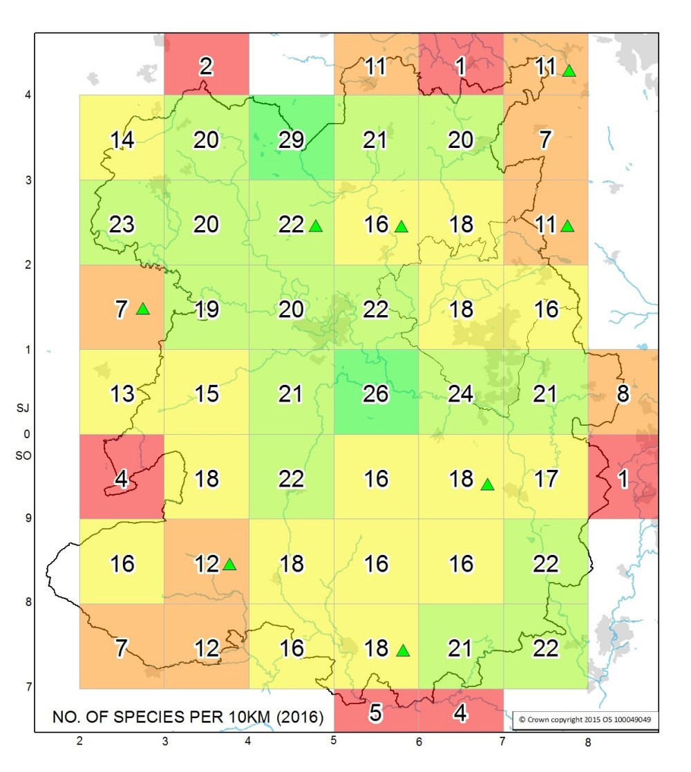
As well as visiting popular well known sites it is important that we do not neglect areas of the county that are under recorded. This map was produced in 2016 and used the Shropshire Ecological Data Network (SEDN) data set to illustrate the dragonfly and damselfly species richness (number of species) recorded in each 10km square in Shropshire. Those areas marked with a green triangle showed an increase in recorded species during 2016. Though historic this map at a glance highlights areas with few species often directly as a result of low recording activity, so if dragonfly spotting in any of the yellow, orange or red areas appeals we would be extremely grateful for any records.
Shropshire Council’s Carbon & Climate Project Officer Dan Wrench has recently produced a Dragonfly Hotspot Map. This uses the up to date SEDN data and allows the user to zoom into a particular 1km square and see which species have been recorded there. Further more each 1km square has a link directly to the NBN where you can access those species records in detail. This is a really great resource and can be accessed via the link below.
It is essential that when recording dragonflies you ensure that you are legally allowed to access the area. Please respect private property at all times and always seek permission from the owner before going onto private land. A number of good relationships have been built up across the county allowing permitted access to private sites and it would be a great shame to lose such access due to the enthusiastic misguided actions of a few.